
Haz una donación
Mapa topográfico Pine Valley
Haga clic en el mapa para ver la altitud.
Haz una donación
Acerca de este mapa
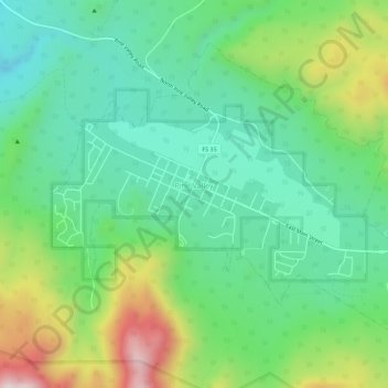
Nombre: Mapa topográfico Pine Valley, altitud, relieve.
Lugar: Pine Valley, Washington County, Utah, 84781, United States (37.37253 -113.53459 37.40749 -113.47849)
Altitud media: 2.092 m
Altitud mínima: 1.887 m
Altitud máxima: 2.539 m
Haz una donación
Otros mapas topográficos
Haga clic en un mapa para ver su topografía, su altitud y su relieve.
Silver Reef
United States > Utah > Washington County > Leeds
Silver Reef is close to the western border of the Colorado Plateau and about 15 miles (24 km) northeast of St. George and 1 mile (1.6 km) west of Leeds. Dixie National Forest, Leeds Creek, the White Reef, and the Pine Valley Mountain Wilderness lie directly west of Silver Reef. The Pine Valley Mountain…
Altitud media: 1.185 m
Haz una donación
Gunlock
United States > Utah > Washington County
The community lies on the Santa Clara River, northwest of the Red Mountains along local roads, northwest of the city of St. George, the county seat of Washington County. Its elevation is 3,658 feet (1,115 m). Although Gunlock is unincorporated, it has a post office, with the ZIP code of 84733.
Altitud media: 1.210 m
Haz una donación
Haz una donación