
Haz una donación
Mapa topográfico Al Badari
Haga clic en el mapa para ver la altitud.
Haz una donación
Acerca de este mapa
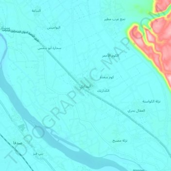
Nombre: Mapa topográfico Al Badari, altitud, relieve.
Lugar: Al Badari, Asyut, 71727, Egypt (26.95222 31.37516 27.03222 31.45516)
Altitud media: 70 m
Altitud mínima: 46 m
Altitud máxima: 270 m
Haz una donación
Otros mapas topográficos
Haga clic en un mapa para ver su topografía, su altitud y su relieve.
Asyut
Köppen-Geiger climate classification system classifies its climate as hot desert (BWh). It is the driest city of Egypt. Luxor, Minya, Qena and Asyut have the widest difference of temperatures between days and nights of any city in Egypt, with almost 16 °C (29 °F) difference. The city of Asyut is sandwiched…
Altitud media: 57 m
Haz una donación
Haz una donación
Haz una donación