
Haz una donación
Mapa topográfico Wusi
Haga clic en el mapa para ver la altitud.
Haz una donación
Acerca de este mapa
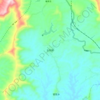
Nombre: Mapa topográfico Wusi, altitud, relieve.
Lugar: Wusi, Dachuan District, Dazhou, Sichuan, China (31.20520 107.05888 31.28520 107.13888)
Altitud media: 382 m
Altitud mínima: 263 m
Altitud máxima: 818 m
Haz una donación
Otros mapas topográficos
Haga clic en un mapa para ver su topografía, su altitud y su relieve.
Haz una donación
Xichang City
Owing to its low latitude and high elevation, Xichang has a monsoon-influenced humid subtropical climate (Köppen Cwa) milder and far sunnier than the Sichuan Basin, with mild, very sunny and dry winters, and very warm, rainy summers. The monthly 24-hour average temperature ranges from 9.9 °C (49.8 °F) in…
Altitud media: 2.319 m
Haz una donación
Kangding
Kangding has a monsoon-influenced climate, lying in the transition between a humid continental (Dwb) and a subtropical highland climate (Cwb) on the Köppen system. Despite the elevation of 2,560 metres (8,400 ft), the diurnal temperature variation averages at most 10.6 °C (19.1 °F) in any month. From April…
Altitud media: 3.331 m
Haz una donación
Luding County
The county is located within the Hengduan Mountains, within the southeastern edge of the Tibetan Plateau. The town of Luqiao, the county seat, sits at an elevation of 1,321 metres (4,334 ft) above sea level. The highest point in the county is Mount Gongga, along the southwestern border with Kangding. Mount…
Altitud media: 3.158 m
Haz una donación
Songpan County
Due to its altitude, Songpan has a humid continental climate (Köppen Dwb), with cool winters and warm, rainy summers. The monthly 24-hour average temperature ranges from −3.4 °C (25.9 °F) in January to 14.8 °C (58.6 °F) in July, and the annual mean is 6.28 °C (43.3 °F). The high elevation also results…
Altitud media: 3.301 m
Jiuzhaigou County
The county consists of nine villages in a valley in Sichuan Province. The main ethnic group in the county is Han, with the second being Tibetan. The county seat has an altitude of about 1,400 m (4,600 ft). It has a total area of 2,041 square miles (5,286 km2). As of 2015, the county's total population was…
Altitud media: 3.201 m
Haz una donación
Jiuzhai Valley National Park
China > Sichuan > Jiuzhaigou County
The Jiuzhaigou valley is part of the Min Mountains on the edge of the Tibetan Plateau and stretches over 72,000 hectares (180,000 acres). It is known for its many multi-level waterfalls, colorful lakes, and snow-capped peaks. Its elevation ranges from 2,000 to 4,500 metres (6,600 to 14,800 ft).
Altitud media: 3.424 m
Pidu District
It is now seeking to attract electronics and IT corporations and, in 2015, applied for elevation to urban district status.
Altitud media: 562 m
Haz una donación
Lugu Lake
China > Sichuan > Yanyuan County > Mukua
Lugu Lake (simplified Chinese: 泸沽湖; traditional Chinese: 瀘沽湖; pinyin: Lúgū Hú) is located in the northwest of the Yunnan plateau, with the middle of the lake forming the border between the Ninglang County of Yunnan Province and the Yanyuan County of Sichuan Province. The formation of the lake is…
Altitud media: 2.750 m
Wolong National Nature Reserve
China > Sichuan > Wenchuan County
The giant panda is the most famous species of the reserve. Other typical larger Carnivora are the Ussuri dhole, Asian black bear, Asiatic golden cat, clouded leopard, red panda, hog badger and yellow-throated marten. Hooved mammals are represented by Sichuan takins, wild boar, musk deer, mainland serows,…
Altitud media: 3.044 m
Haz una donación
Litang County
Litang County (Tibetan: ལི་ཐང་རྫོང་།; Chinese: 理塘县) is southwest of Garzê Tibetan Autonomous Prefecture, in Sichuan, China, in the traditional Tibetan region of Kham. It contains 7 towns and a population of more than 60,000 in 2020. Due to its elevation and mountainous terrain,…
Altitud media: 4.217 m
Haz una donación
Liangshan
Owing to its low latitude and high elevation, Liangshan has a mild climate. Under the Köppen system, the prefecture belongs to the humid subtropical zone (Köppen Cwa). Winters feature mild days and cool nights, while summers are very warm and humid. Monthly daily mean temperatures range from 9.6 °C (49.3…
Altitud media: 2.434 m
Haz una donación
Kangding
Kangding has a monsoon-influenced climate, lying in the transition between a humid continental (Dwb) and a subtropical highland climate (Cwb) on the Köppen system. Despite the elevation of 2,560 metres (8,400 ft), the diurnal temperature variation averages at most 10.6 °C (19.1 °F) in any month. From April…
Altitud media: 3.331 m
Heishui County
Heishui County (Chinese: 黑水县; Tibetan: ཁྲོ་ཆུ་རྫོང་།; Qiang: Vvlukvua) is a county in the north of Sichuan Province, China. It is under the administration of the Ngawa Tibetan and Qiang Autonomous Prefecture. The county has an area of 1,682 square miles (4,356 km2) and its…
Altitud media: 3.656 m
Haz una donación
Haz una donación
Litang County
Litang County (Tibetan: ལི་ཐང་རྫོང་།; Chinese: 理塘县) is southwest of Garzê Tibetan Autonomous Prefecture, in Sichuan, China, in the traditional Tibetan region of Kham. It contains 7 towns and a population of more than 60,000 in 2020. Due to its elevation and mountainous terrain,…
Altitud media: 4.217 m
Jiuzhaigou County
The county consists of nine villages in a valley in Sichuan Province. The main ethnic group in the county is Han, with the second being Tibetan. The county seat has an altitude of about 1,400 m (4,600 ft). It has a total area of 2,041 square miles (5,286 km2). As of 2015, the county's total population was…
Altitud media: 3.201 m
Langzhong City
Langzhong is located in the northeast of the province and the northern part of the Sichuan Basin on the middle reaches of the Jialing River. Within the city's administrative area, elevations generally increase from southwest to northeast and range from 328 metres (1,076 ft) to 888 metres (2,913 ft), while…
Altitud media: 480 m
Haz una donación
Haz una donación
Haz una donación
Haz una donación
Sêrtar County
Sêrtar is remotely located and requires more than half a day's driving if travelling from Chengdu via Maerkang. It is also possible to travel from Xining, the capital of Qinghai. Sêrtar is at an altitude of around 4,100 metres above sea level. Temperatures range from 30 degrees Celsius in the summer and -25…
Altitud media: 4.210 m
Haz una donación
Haz una donación
Haz una donación
Langzhong City
Langzhong is located in the northeast of the province and the northern part of the Sichuan Basin on the middle reaches of the Jialing River. Within the city's administrative area, elevations generally increase from southwest to northeast and range from 328 metres (1,076 ft) to 888 metres (2,913 ft), while…
Altitud media: 480 m
Haz una donación
Sêrxü County
Sêrxü (sershul) County is situated at the northwest corner of Sichuan province, and is also the westernmost county-level division of the province. Its area is approximately 25,000 km2, mainly covered by grasslands. The average elevation is 4,200 m above sea level.
Altitud media: 4.491 m
Jiulong County
Due to its elevation, Jiulong County has a subtropical highland climate (Köppen Cwb), with strong monsoonal influences; winters are frosty and summers warm with frequent rain. The monthly 24-hour average temperature ranges from 1.6 °C (34.9 °F) in December and January to 15.3 °C (59.5 °F) in July, while…
Altitud media: 3.599 m
Haz una donación
Huanglong Scenic and Historic Interest Area
China > Sichuan > Songpan County
Repeated glaciation events, the unique terrane structure, the formation of tufa, the stratum of carbonic acid rock, and climatic conditions such as Arctic-alpine sunlight have created this world-famous travertine landscape. Huanglong covers an area of 700 km2 at an altitude between 1700m and 5588m. Major…
Altitud media: 3.350 m
Kangding
Kangding has a monsoon-influenced climate, lying in the transition between a humid continental (Dwb) and a subtropical highland climate (Cwb) on the Köppen system. Despite the elevation of 2,560 metres (8,400 ft), the diurnal temperature variation averages at most 10.6 °C (19.1 °F) in any month. From April…
Altitud media: 3.331 m
Haz una donación
Jiuzhaigou County
The county consists of nine villages in a valley in Sichuan Province. The main ethnic group in the county is Han, with the second being Tibetan. The county seat has an altitude of about 1,400 m (4,600 ft). It has a total area of 2,041 square miles (5,286 km2). As of 2015, the county's total population was…
Altitud media: 3.201 m
Haz una donación
Hongyuan County
This is the only county under the Prefecture with entirely yak herding pastoralists. The average altitude above the sea level is 3,600 m (11,800 ft). About 8,398 square meter and about 40,000 people reside (2004) mostly Amdo Tibetan. The language is spoken is one of the most conservative dialect among the Amdo…
Altitud media: 3.706 m
Jiulong County
Due to its elevation, Jiulong County has a subtropical highland climate (Köppen Cwb), with strong monsoonal influences; winters are frosty and summers warm with frequent rain. The monthly 24-hour average temperature ranges from 1.6 °C (34.9 °F) in December and January to 15.3 °C (59.5 °F) in July, while…
Altitud media: 3.599 m
Haz una donación
Haz una donación
Litang County
Litang County (Tibetan: ལི་ཐང་རྫོང་།; Chinese: 理塘县) is southwest of Garzê Tibetan Autonomous Prefecture, in Sichuan, China, in the traditional Tibetan region of Kham. It contains 7 towns and a population of more than 60,000 in 2020. Due to its elevation and mountainous terrain,…
Altitud media: 4.217 m
Wuhou District
The terrain of Wuhou District is flat, sloping from northwest to southeast, with an average altitude of 502.5 meters. The plains within the territory are composed of flood plains, alluvial fans, fan plains and other plains. The geological structure of the entire region is mainly Quaternary loose accumulations.
Altitud media: 492 m
Haz una donación