
Gracias por apoyar a este sitio ❤️
Haz una donación
Haz una donación
Mapa topográfico Xiahe
Haga clic en el mapa para ver la altitud.
Gracias por apoyar a este sitio ❤️
Haz una donación
Haz una donación
Xiahe
Xiahe (Sangqu) is found in the southern portion of Gansu province, along the western border with Qinghai province. It lies along the Daxia and Zhao rivers. It is on the northeast edge of the Tibetan Plateau. The average elevation is 2,900 to 3,100 m (9,500 to 10,200 ft) with the highest being 4,636 m (15,210 ft) and the lowest 2,160 m (7,087 ft).
Gracias por apoyar a este sitio ❤️
Haz una donación
Haz una donación
Acerca de este mapa
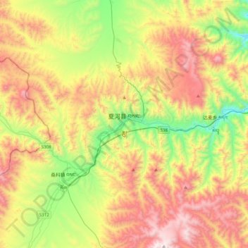
Nombre: Mapa topográfico Xiahe, altitud, relieve.
Altitud media: 3.366 m
Altitud mínima: 2.704 m
Altitud máxima: 4.203 m
Gracias por apoyar a este sitio ❤️
Haz una donación
Haz una donación