
Mapa topográfico Thandiani
Haga clic en el mapa para ver la altitud.
Acerca de este mapa
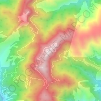
Nombre: Mapa topográfico Thandiani, altitud, relieve.
Altitud media: 2.241 m
Altitud mínima: 1.757 m
Altitud máxima: 2.690 m
Otros mapas topográficos
Haga clic en un mapa para ver su topografía, su altitud y su relieve.
Lora Tehsil
Pakistan > Khyber Pakhtunkhwa > Abbottābād District
Lora is located at an altitude of 1148 metres (3769 feet). It is situated in the southern part of Abbottabad District formerly part of Havelian Tehsil, it is now the headquarters of Lora Tehsil. It is bounded by the following union councils, Nara to the north, Nagri Totial to the north and east, Goreeni to the…
Altitud media: 1.359 m