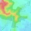
Mapa topográfico Splitters Creek
Haga clic en el mapa para ver la altitud.
Splitters Creek
The Splitters Creek valley is classed as a very high fire risk by the NSW Rural Fire Service (one of two in NSW) due to the topography and the access with only 1 road in and out.
Acerca de este mapa

Nombre: Mapa topográfico Splitters Creek, altitud, relieve.
Altitud media: 214 m
Altitud mínima: 141 m
Altitud máxima: 479 m
Otros mapas topográficos
Haga clic en un mapa para ver su topografía, su altitud y su relieve.