
Gracias por apoyar a este sitio ❤️
Haz una donación
Haz una donación
Mapa topográfico Dhandhuka
Haga clic en el mapa para ver la altitud.
Gracias por apoyar a este sitio ❤️
Haz una donación
Haz una donación
Dhandhuka
Dhandhuka is located at 22°22′N 71°59′E / 22.37°N 71.98°E / 22.37; 71.98. It has an average elevation of 24 metres (78 feet). The city is 105 km from District center Ahmedabad, on state highway No 1. to Bhavnagar. Bhavnagar is 95 km from Dhandhuka town.
Gracias por apoyar a este sitio ❤️
Haz una donación
Haz una donación
Acerca de este mapa
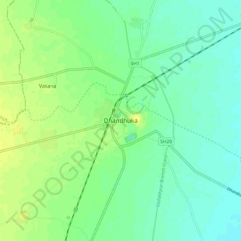
Nombre: Mapa topográfico Dhandhuka, altitud, relieve.
Altitud media: 21 m
Altitud mínima: 13 m
Altitud máxima: 30 m
Gracias por apoyar a este sitio ❤️
Haz una donación
Haz una donación