
Gracias por apoyar a este sitio ❤️
Haz una donación
Haz una donación
Mapa topográfico Piedmont
Haga clic en el mapa para ver la altitud.
Gracias por apoyar a este sitio ❤️
Haz una donación
Haz una donación
Acerca de este mapa
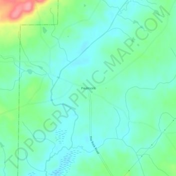
Nombre: Mapa topográfico Piedmont, altitud, relieve.
Lugar: Piedmont, Lamar County, Georgia, 30285, United States (32.99707 -84.27075 33.03707 -84.23075)
Altitud media: 225 m
Altitud mínima: 199 m
Altitud máxima: 306 m
Gracias por apoyar a este sitio ❤️
Haz una donación
Haz una donación
Otros mapas topográficos
Haga clic en un mapa para ver su topografía, su altitud y su relieve.
Barnesville
United States > Georgia > Lamar County
Barnesville sits on a low ridge at an elevation of 850 feet (260 m) above sea level. Hog Mountain rises above the city to the north, with a summit elevation of 1,015 feet (309 m). The north side of the city drains via Big Towaliga Creek to the Little Towaliga River, the Towaliga River, and eventually the…
Altitud media: 247 m
Gracias por apoyar a este sitio ❤️
Haz una donación
Haz una donación