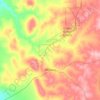
Mapa topográfico Geraldton
Haga clic en el mapa para ver la altitud.
Acerca de este mapa

Nombre: Mapa topográfico Geraldton, altitud, relieve.
Lugar: Geraldton, Western Australia, 6530, Australia (-28.93035 114.45472 -28.61035 114.77472)
Altitud media: 33 m
Altitud mínima: -1 m
Altitud máxima: 223 m
Otros mapas topográficos
Haga clic en un mapa para ver su topografía, su altitud y su relieve.


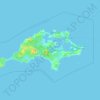






Rockingham
Rockingham is topographically flat, has sandy soils and coastal vegetation. It has a northern aspect to Cockburn Sound, from Rockingham Beach and Palm Beach.
Altitud media: 4 m