
Mapa topográfico Ealand
Haga clic en el mapa para ver la altitud.
Acerca de este mapa
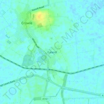
Nombre: Mapa topográfico Ealand, altitud, relieve.
Lugar: Ealand, North Lincolnshire, England, DN17 4JD, United Kingdom (53.57656 -0.83629 53.61656 -0.79629)
Altitud media: 4 m
Altitud mínima: -1 m
Altitud máxima: 20 m
Otros mapas topográficos
Haga clic en un mapa para ver su topografía, su altitud y su relieve.
Barrow-upon-Humber
United Kingdom > England > North Lincolnshire > Barrow-upon-Humber
Altitud media: 18 m
Haxey
United Kingdom > England > North Lincolnshire
The civil parish includes the town of Haxey and the village of Westwoodside, and the hamlets of Haxey Carr, High Burnham (the highest elevation of the Isle of Axholme), Low Burnham, East Lound, Graizelound and Upperthorpe which is conjoined to Westwoodside.
Altitud media: 7 m