

Mapa topográfico Mount Salak
Haga clic en el mapa para ver la altitud.
Mount Salak
Mount Salak is popular for many mountain climbing clubs, especially Route II, because of the difficulty involved in reaching the peak. Climbers bring water with them, especially through Post I at Kawah Ratu Route. A water source, supplied by rain, exists at an altitude of 2,211 m (7,254 ft) on this route.
Acerca de este mapa
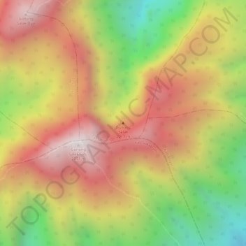
Nombre: Mapa topográfico Mount Salak, altitud, relieve.
Lugar: Mount Salak, Tamansari, Bogor, West Java, Java, Indonesia (-6.71366 106.73849 -6.71356 106.73859)
Altitud media: 1.770 m
Altitud mínima: 1.214 m
Altitud máxima: 2.183 m
Otros mapas topográficos
Haga clic en un mapa para ver su topografía, su altitud y su relieve.


Megamendung
Much of the district lies at an elevation of 500-600 metres, which moderates the temperature, and causing contrast to the heat of Greater Jakarta and other adjacent low-lying lands. Though much of the built-up area is not necessarily on rugged terrain, uneven ground is the most common terrain as it stands…
Altitud media: 738 m


Megamendung
Much of the district lies in an elevation of 500-600 metres, which moderates the temperature, and causing contrast to the heat of Greater Jakarta and other adjacent low-lying lands. Though much of the built-up area is not necessarily on rugged terrain, uneven ground is the most common terrain as it stands…
Altitud media: 742 m


Cisarua
Cisarua is a location and district in the Bogor Regency, located in the province of West Java, with a population of 127,096 in 2020. The district is known for its mild climate, tea fields, and extensive views, being located in a rather high altitude.
Altitud media: 1.310 m
