
Mapa topográfico Salto
Mapa interactivo
Haga clic en el mapa para ver la altitud.
Acerca de este mapa
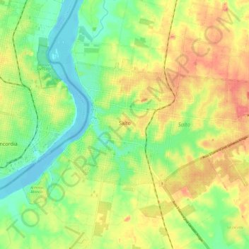
Nombre: Mapa topográfico Salto, altitud, relieve.
Lugar: Salto, 50000, Uruguay (-31.41614 -57.99652 -31.36290 -57.87881)
Altitud media: 34 m
Altitud mínima: -3 m
Altitud máxima: 74 m
Built on hills and bluffs, the city is situated near the Rio Uruguay's 'big jump' falls, which is also the location of the Salto Grande Dam. The land is low lying alongside the river bank, with an elevation of 48 metres (157 ft) above sea level.