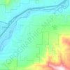
Mapa topográfico Silt
Haga clic en el mapa para ver la altitud.
Acerca de este mapa

Nombre: Mapa topográfico Silt, altitud, relieve.
Lugar: Silt, Garfield County, Colorado, United States (39.52217 -107.66846 39.55909 -107.61070)
Altitud media: 1.695 m
Altitud mínima: 1.641 m
Altitud máxima: 1.849 m
Otros mapas topográficos
Haga clic en un mapa para ver su topografía, su altitud y su relieve.
Douglas Pass
United States > Colorado > Garfield County
Douglas Pass, elevation 8,205 feet (2,501 meters), is a mountain pass in the Book Cliffs of western Colorado. It is located in Garfield County and is traversed by State Highway 139. The pass divides the watersheds of West Douglas Creek to the north and East Salt Creek to the south. It is named for the Northern…
Altitud media: 2.435 m