
Haz una donación
Mapa topográfico Tanggulashan
Haga clic en el mapa para ver la altitud.
Haz una donación
Tanggulashan
The Tanggula settlement, also known as Marquwo, Tuotuoheyan, or Togtogquwo, is located at 4,535 metres (14,879 ft) above sea level in the central part of Tanggula Mountains, as the town's name indicates. The town's area includes the Geladaindong Peak, a mountain which stands at 6,621 metres (21,722 ft) in elevation. The mountain is notable for its proximity to the source of the Tuotuo River, which itself is one of the sources of the Yangtze River. The area around the peak is protected as part of the Sanjiangyuan National Nature Reserve, which the town is located near. The main settlement is located near the highway and railway crossing of the Tuotuo River, which is one of the headwaters of the Yangtze. This settlement is served by the Togtogquwo railway station. Other settlements in the same highway/railway corridor, further south, are Tongtian Heyan ("Tongtian Riverside"), Yanshiping, Wenquan, and Tanggula Bingzhan ("Tanggula Military Post").
Haz una donación
Acerca de este mapa
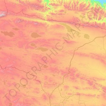
Nombre: Mapa topográfico Tanggulashan, altitud, relieve.
Altitud media: 4.756 m
Altitud mínima: 3.381 m
Altitud máxima: 6.537 m
Haz una donación