
Gracias por apoyar a este sitio ❤️
Haz una donación
Haz una donación
Mapa topográfico Rapsani
Haga clic en el mapa para ver la altitud.
Gracias por apoyar a este sitio ❤️
Haz una donación
Haz una donación
Rapsani
Rapsani is sited at an altitude of 600 meters. The location of Peneus river at the level of the station Rapsani is a scenic landscape. The town is close (5 km) from a station that bears the same name.
Gracias por apoyar a este sitio ❤️
Haz una donación
Haz una donación
Acerca de este mapa
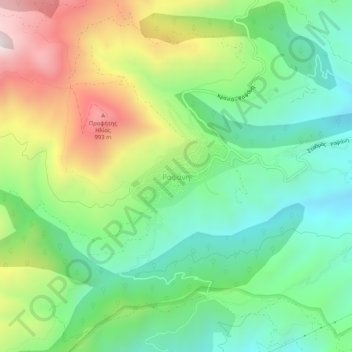
Nombre: Mapa topográfico Rapsani, altitud, relieve.
Altitud media: 501 m
Altitud mínima: 150 m
Altitud máxima: 1.123 m
Gracias por apoyar a este sitio ❤️
Haz una donación
Haz una donación