
Mapa topográfico Santa Ana
Mapa interactivo
Haga clic en el mapa para ver la altitud.
Acerca de este mapa
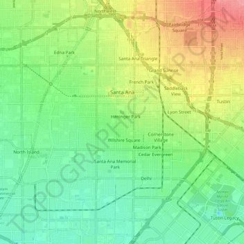
Nombre: Mapa topográfico Santa Ana, altitud, relieve.
Lugar: Santa Ana, Orange County, California, United States (33.69165 -117.94395 33.78401 -117.83035)
Altitud media: 30 m
Altitud mínima: -1 m
Altitud máxima: 80 m
Santa Ana is nested on flat, low-lying plains with little land elevation change. Running through the west end of the city is the mostly channelized Santa Ana River, which is also largely seasonal due to the construction of the Prado Dam and Seven Oaks Dam. The river has caused several severe floods in the 20th century, and is a continued threat despite the existence of the dams.
Otros mapas topográficos
Haga clic en un mapa para ver su topografía, su altitud y su relieve.
Irvine
United States > California > Orange County
Irvine, Orange County, CAL Fire Southern Region, California, United States
Altitud media: 66 m