
Mapa topográfico Channel Islands
Haga clic en el mapa para ver la altitud.
Channel Islands
The Channel Islands at low elevations are virtually frost-free and constitute one of the few such areas in the 48 contiguous US states. It snows only rarely, on higher mountain peaks.
Acerca de este mapa
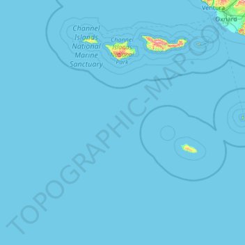
Nombre: Mapa topográfico Channel Islands, altitud, relieve.
Altitud media: 4 m
Altitud mínima: 0 m
Altitud máxima: 689 m
Otros mapas topográficos
Haga clic en un mapa para ver su topografía, su altitud y su relieve.
Jalama Beach County Park
United States > California > Santa Barbara County > Jalama
Altitud media: 40 m
Las Positas Meadows
United States > California > Santa Barbara County > Santa Barbara
Altitud media: 66 m