
Gracias por apoyar a este sitio ❤️
Haz una donación
Haz una donación
Mapa topográfico Pine
Haga clic en el mapa para ver la altitud.
Gracias por apoyar a este sitio ❤️
Haz una donación
Haz una donación
Pine
Pine and the adjacent community of Strawberry are rapidly growing vacation and retirement centers in north-central Arizona, below the Mogollon Rim. Pine's elevation is 5,448 feet (1,661 m), and the Pine post office was established in 1884.
Gracias por apoyar a este sitio ❤️
Haz una donación
Haz una donación
Acerca de este mapa
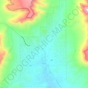
Nombre: Mapa topográfico Pine, altitud, relieve.
Lugar: Pine, Gila County, Arizona, United States (34.37097 -111.47143 34.41879 -111.44099)
Altitud media: 1.794 m
Altitud mínima: 1.613 m
Altitud máxima: 2.221 m
Gracias por apoyar a este sitio ❤️
Haz una donación
Haz una donación