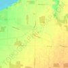
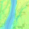
Mapa topográfico Johnston Channel
Haga clic en el mapa para ver la altitud.
Johnston Channel
The creek begins at the right bank of the Chenail Ecarté (The Snye) at an elevation of 175 metres (574 ft), west of the community of Wallaceburg. It meanders south, then turns southwest, and reaches its mouth at Johnston Bay on Lake St. Clair, at an elevation of 175 metres (574 ft). Lake St. Clair flows via the Detroit River to Lake Erie.
Acerca de este mapa

Nombre: Mapa topográfico Johnston Channel, altitud, relieve.
Altitud media: 176 m
Altitud mínima: 172 m
Altitud máxima: 185 m
Otros mapas topográficos
Haga clic en un mapa para ver su topografía, su altitud y su relieve.