
Haz una donación
Mapa topográfico Dyatlov Pass
Haga clic en el mapa para ver la altitud.
Haz una donación
Dyatlov Pass
Diaries and cameras found around their last campsite made it possible to track the group's route up to the day preceding the incident. On 31 January, the group arrived at the edge of a highland area and began to prepare for climbing. In a wooded valley, they cached surplus food and equipment that would be used for the trip back. The next day, the hikers started to move through the pass. It seems they planned to get over the pass and make camp for the next night on the opposite side, but because of worsening weather conditions—snowstorms and decreasing visibility—they lost their direction and deviated west, toward the top of Kholat Syakhl. When they realised their mistake, the group decided to set up camp there on the slope of the mountain, rather than move 1.5 kilometres (0.93 mi) downhill to a forested area that would have offered some shelter from the weather. Yudin speculated, "Dyatlov probably did not want to lose the altitude they had gained, or he decided to practice camping on the mountain slope."
Haz una donación
Acerca de este mapa
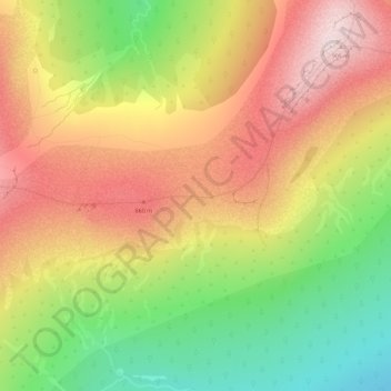
Nombre: Mapa topográfico Dyatlov Pass, altitud, relieve.
Altitud media: 707 m
Altitud mínima: 494 m
Altitud máxima: 899 m
Haz una donación