Geolocalizar
👉 Easily get elevation data in JSON, GeoTIFF and KML formats using Elevation API
Gracias por apoyar a este sitio ❤️
Haz una donación

Mapa topográfico Hatfield Forest

Haga clic en el mapa para ver la altitud.

👉 Easily get elevation data in JSON, GeoTIFF and KML formats using Elevation API
Gracias por apoyar a este sitio ❤️
Haz una donación

Acerca de este mapa

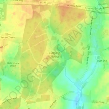
Nombre: Mapa topográfico Hatfield Forest, altitud, relieve.

Lugar: Hatfield Forest, Takeley Street, Uttlesford, Essex, East of England, England, CM22 6NH, United Kingdom (51.84444 0.21699 51.86888 0.24692)

Altitud media: 90 m

Altitud mínima: 70 m

Altitud máxima: 102 m

Otros mapas topográficos

Haga clic en un mapa para ver su topografía, su altitud y su relieve.