
Haz una donación
Mapa topográfico Thengapattinam
Haga clic en el mapa para ver la altitud.
Haz una donación
Thengapattinam
Thengapattanam is located in the South western coast of India bordering the Arabian Sea to the west, western ghats to the north, and vast fertile plains with intermittent Rocky hills to the east. The town is 11 km into the Tamil Nadu border from Kerala. The Kerala state capital Thiruvananthapuram is 45 km away from here, whereas Nagercoil is 35 km away. It shares borders with Erayumanthurai, and Amsi villages on either side. The mean elevation of the town is 9 ft (2.7 m) with the highest point Chentapalli Rock being 50 ft (15 m) high above sea level. The Thamirabarani River wraps around most parts of the Kanyakumari district and becomes Kuzhithurai River before reaching Thengapattanam Estuary.
Haz una donación
Acerca de este mapa
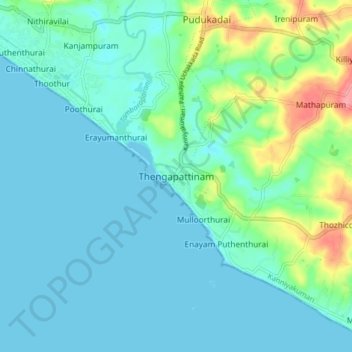
Nombre: Mapa topográfico Thengapattinam, altitud, relieve.
Altitud media: 17 m
Altitud mínima: -1 m
Altitud máxima: 86 m
Haz una donación