
Mapa topográfico Nabay
Mapa interactivo
Haga clic en el mapa para ver la altitud.
Acerca de este mapa
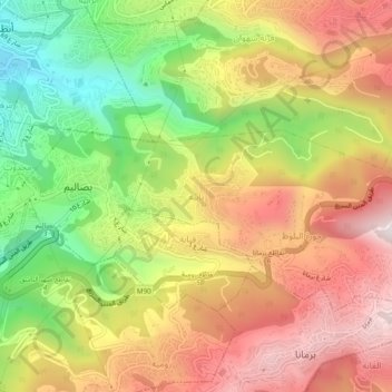
Nombre: Mapa topográfico Nabay, altitud, relieve.
Lugar: Nabay, Matn District, Mount Lebanon Governorate, 1204, Lebanon (33.87904 35.59888 33.91904 35.63888)
Altitud media: 443 m
Altitud mínima: 19 m
Altitud máxima: 829 m
Nabay (Arabic: نابيه, from the Aramaic: נביא ; ܢܒܺܝܶ̈ܐ) is a village located in the Matn District (kada), Mount Lebanon Governorate (Mohafazat). Nabay is located 16 kilometers (9.9424 mi) away from the capital Beirut. Its elevation is 500 meters (1640.5 ft - 546.8 yd) above sea level. Nabay surface stretches for 388 hectares (3.88 km² - 1.49768 mi²).