
Haz una donación
Mapa topográfico Beechgrove
Haga clic en el mapa para ver la altitud.
Haz una donación
Acerca de este mapa
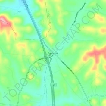
Nombre: Mapa topográfico Beechgrove, altitud, relieve.
Altitud media: 289 m
Altitud mínima: 243 m
Altitud máxima: 374 m
Haz una donación
Otros mapas topográficos
Haga clic en un mapa para ver su topografía, su altitud y su relieve.
Tullahoma
United States > Tennessee > Coffee County
Tullahoma is located in the southwest corner of Coffee County at 35°22′7″N 86°12′48″W / 35.36861°N 86.21333°W / 35.36861; -86.21333 (35.368511, -86.213258), and extends south into Franklin County. It is situated at the edge of the Highland Rim, with flatter topography than in the…
Altitud media: 323 m
Haz una donación