
Haz una donación
Mapa topográfico Kunjah
Haga clic en el mapa para ver la altitud.
Haz una donación
Acerca de este mapa
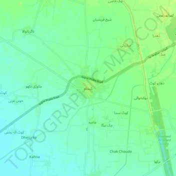
Nombre: Mapa topográfico Kunjah, altitud, relieve.
Altitud media: 227 m
Altitud mínima: 221 m
Altitud máxima: 234 m
Haz una donación
Otros mapas topográficos
Haga clic en un mapa para ver su topografía, su altitud y su relieve.
Lalamusa
Pakistan > Punjab > Gujrat District
Lalamusa is situated on the Grand Trunk Road (National Highway 5). It is geographically located at latitude (32.7 degrees) 32° 42' 0" North of the Equator and longitude (73.96 degrees) 73° 57' 35" East of the Prime Meridian on the Map of the world and lies at an altitude of about 250 meters.
Altitud media: 254 m