
Haz una donación
Mapa topográfico Gangolihāt
Haga clic en el mapa para ver la altitud.
Haz una donación
Gangolihāt
Gangolihat is located at 29°29′N 80°03′E / 29.48°N 80.05°E / 29.48; 80.05. It has an average elevation of 1,760 metres (5,773 feet). It is 78 km from Pithoragarh. The main town is at a hill top. The region is surrounded by two rivers Saryu and Ramganga. Which meet at Ghat at the foothill of the region. These two rivers make it like a Garland on the shoulders of mighty Himalaya. These two rivers gave the name to the region Gang (River in Kumaoni) + Awali (Garland) making Gangawali which became Gangoli later on. and Hat were the main markets/ gathering place for local people in past. Which made the name of Gangolihat.
Haz una donación
Acerca de este mapa
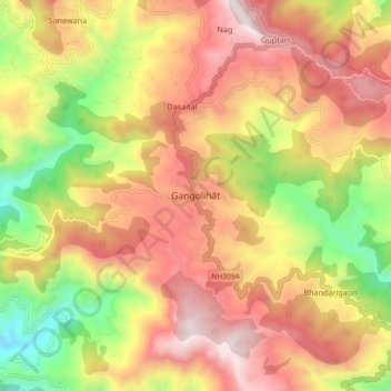
Nombre: Mapa topográfico Gangolihāt, altitud, relieve.
Altitud media: 1.532 m
Altitud mínima: 790 m
Altitud máxima: 2.157 m
Haz una donación