
Mapa topográfico Jahazpur
Mapa interactivo
Haga clic en el mapa para ver la altitud.
Jahazpur
Jahazpur is located at 25°37′N 75°17′E / 25.62°N 75.28°E / 25.62; 75.28. It has an average elevation of 334 m (1,096 ft). There is a Jain Mandir in the shape of a Jahaz (ship) being built there popularized as Atishay Kshetra dedicated to Bhagwan Munisuvrata Nath.The under construction temple is on the Jahazpur-Shahpura (Bhilwara) State Highway No. 39 which is around 24 km from Deoli,a town in the Tonk District of Rajasthan on the National Highway running from Jabalpur to Jaipur.
Acerca de este mapa
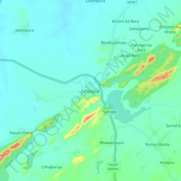
Nombre: Mapa topográfico Jahazpur, altitud, relieve.
Lugar: Jahazpur, Jahazpur Tehsil, Bhilwara, Rajasthan, 305409, India (25.57847 75.23711 25.65847 75.31711)
Altitud media: 350 m
Altitud mínima: 318 m
Altitud máxima: 514 m