
Gracias por apoyar a este sitio ❤️
Haz una donación
Haz una donación
Mapa topográfico Methana
Haga clic en el mapa para ver la altitud.
Gracias por apoyar a este sitio ❤️
Haz una donación
Haz una donación
Methana
Since 1991, the peninsula has been investigated by the team of ETH Zürich geologically and cartographically. From this, a topographical map of the entire peninsula at a scale of 1:25,000 was made. An interactive 3D map was created and is on the World Wide Web. Also a rich photographic archive with about 10.000 color slides has been produced (see links below).
Gracias por apoyar a este sitio ❤️
Haz una donación
Haz una donación
Acerca de este mapa
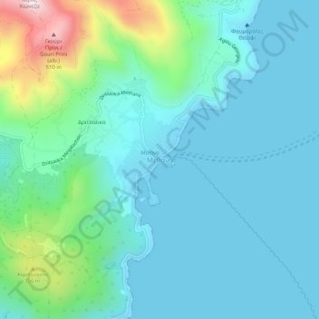
Nombre: Mapa topográfico Methana, altitud, relieve.
Altitud media: 123 m
Altitud mínima: -2 m
Altitud máxima: 667 m
Gracias por apoyar a este sitio ❤️
Haz una donación
Haz una donación