
Haz una donación
Mapa topográfico Townsend
Haga clic en el mapa para ver la altitud.
Haz una donación
Townsend
Just to the north and west of Townsend, the Foothills Parkway is a national parkway that traverses Chilhowee Mountain and offers multiple scenic overlooks at high elevations, with views of the Smokies to the south and the Tennessee Valley and Cumberland Plateau to the north and west. As of 2016, road construction on the parkway to complete the "missing link" from Walland to Wears Valley can be seen from Townsend during the mid-day and afternoon. This section eventually opened in late 2018, more than half a century after the first section opened in 1966.
Haz una donación
Acerca de este mapa
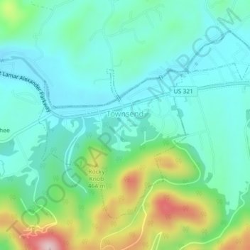
Nombre: Mapa topográfico Townsend, altitud, relieve.
Altitud media: 376 m
Altitud mínima: 305 m
Altitud máxima: 582 m
Haz una donación
Otros mapas topográficos
Haga clic en un mapa para ver su topografía, su altitud y su relieve.
Haz una donación
Haz una donación
Haz una donación
Haz una donación
Haz una donación
Haz una donación
Haz una donación