
Haz una donación
Mapa topográfico Kritsa
Haga clic en el mapa para ver la altitud.
Haz una donación
Kritsa
Kritsa (Greek: Κριτσά, romanized: Critsá) is one of the oldest and most picturesque villages in Crete, Greece, built amphitheatrically on a rock hill, named Kastellos, surrounded by olive groves, at an altitude of 375 m. It is part of the municipality of Agios Nikolaos. During the Middle Ages, it was thought to be the largest village in Crete. Kritsa has been destroyed many times during the last centuries because it participated in all of Crete's revolutions. It is located 10 km from Agios Nikolaos and has about 2200 inhabitants who live in different neighborhoods named Palemilos, Koukistres, Christos and Pergiolikia.
Haz una donación
Acerca de este mapa
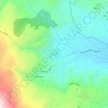
Nombre: Mapa topográfico Kritsa, altitud, relieve.
Altitud media: 446 m
Altitud mínima: 183 m
Altitud máxima: 1.073 m
Haz una donación