
Gracias por apoyar a este sitio ❤️
Haz una donación
Haz una donación
Mapa topográfico Hatpipalya
Haga clic en el mapa para ver la altitud.
Gracias por apoyar a este sitio ❤️
Haz una donación
Haz una donación
Hatpipalya
Hatpipliya lies on the Malwa Plateau. Due of its high elevation and inland location, even during the hottest months of the year, the nights are relatively cool, which is known as Shab-e-Malwa. Three distinct seasons are observed: summer, monsoon and winter. Hatpipliya gets moderate rainfall of 960 millimetres (38 in), mostly during July–September due to the southwest monsoon.
Gracias por apoyar a este sitio ❤️
Haz una donación
Haz una donación
Acerca de este mapa
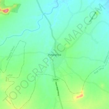
Nombre: Mapa topográfico Hatpipalya, altitud, relieve.
Altitud media: 523 m
Altitud mínima: 497 m
Altitud máxima: 602 m
Gracias por apoyar a este sitio ❤️
Haz una donación
Haz una donación