
Haz una donación
Mapa topográfico Tashkorgan Town
Haga clic en el mapa para ver la altitud.
Haz una donación
Tashkorgan Town
Stein argued that, judging from the topography and remains found around Tashkurgan, the fort and associated settlements had clearly been central to the broader Sarikol area, controlling routes from the Oxus to the oases of southern Turkestan.
Haz una donación
Acerca de este mapa
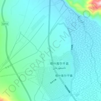
Nombre: Mapa topográfico Tashkorgan Town, altitud, relieve.
Altitud media: 3.109 m
Altitud mínima: 3.046 m
Altitud máxima: 3.712 m
Haz una donación
Otros mapas topográficos
Haga clic en un mapa para ver su topografía, su altitud y su relieve.
Gasherbrum II
China > Xinjiang > Taxkorgan Tajik Autonomous County > Dafdar
Gasherbrum II is located on the border of Gilgit–Baltistan, Pakistan, and Xinjiang, China. It is part of the Karakoram mountain range in the Himalayas, and located at the top of the Baltoro Glacier. With an elevation of 8,034 metres (26,358 ft) it is the third-highest member of the Gasherbrum group, behind…
Altitud media: 7.098 m
Broad Peak
China > Xinjiang > Taxkorgan Tajik Autonomous County > Dafdar
Broad Peak is one of the eight-thousanders, and is located in the Karakoram range spanning Gilgit-Baltistan, Pakistan and Xinjiang, China. It is the 12th highest mountain in the world at 8,051 metres (26,414 ft) elevation above sea level. The first ascent of this mountain was in June 1957, accomplished by…
Altitud media: 7.117 m
Alar National Wetland Park
China > Xinjiang > Taxkorgan Tajik Autonomous County > Tashkorgan Town > 瓦尔希迭村 ۋەرشىدې
Altitud media: 3.074 m
Haz una donación
Qoghushluq
China > Xinjiang > Taxkorgan Tajik Autonomous County > 库科西鲁格乡 قوغۇشلۇق يېزىسى
Altitud media: 2.984 m