
Haz una donación
Mapa topográfico Qanateghestan
Haga clic en el mapa para ver la altitud.
Haz una donación
Acerca de este mapa
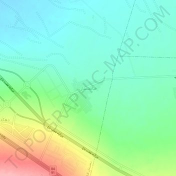
Nombre: Mapa topográfico Qanateghestan, altitud, relieve.
Lugar: Qanateghestan, بخش ماهان, Kerman County, Kerman Province, Iran (30.05810 57.21315 30.09810 57.25315)
Altitud media: 1.857 m
Altitud mínima: 1.821 m
Altitud máxima: 1.941 m
Haz una donación
Otros mapas topográficos
Haga clic en un mapa para ver su topografía, su altitud y su relieve.
Kerman
Iran > Kerman Province > Kerman County
Kerman is located on a high margin of Kavir-e Lut (Lut Desert) in the south-central part of Iran. The city is surrounded by mountains. Kerman is also located along the Saheb Al Zaman mountain. The city is 1,755 m (5,758 ft) above sea level, making it third in elevation among provincial capitals in Iran. Winter…
Altitud media: 1.784 m
Haz una donación
Haz una donación
Lut Desert
Iran > Kerman Province > Kerman County > دهستان تکاب
The eastern part of Dasht-e Lut is a low plateau covered with salt flats with lowest elevations around 110 m above sea level (30.398609 N, 58.493041 E). In contrast, the center has been sculpted by the wind into a series of parallel ridges and furrows, extending over 150 km (93 mi) and reaching 75 metres (246…
Altitud media: 709 m
Haz una donación