
Haz una donación
Mapa topográfico Kosmas
Haga clic en el mapa para ver la altitud.
Haz una donación
Kosmas
Kosmas (Greek: Κοσμάς) is a mountain village and a former community in Arcadia, Peloponnese, Greece. It is considered a traditional settlement. Since the 2011 local government reform it is part of the municipality South Kynouria, of which it is a municipal unit. The municipal unit has an area of 85.220 km2. Kosmas is situated in the southeastern part of the Parnon mountains, at about 1150 m elevation, on the road from Skala (Laconia) to Leonidio. It is 13 km southwest of Leonidio, 28 km east of Sparti, 28 km northeast of Skala, 35 km south of Argos and 57 km southeast of Tripoli. Kosmas has a school, a church and a library.
Haz una donación
Acerca de este mapa
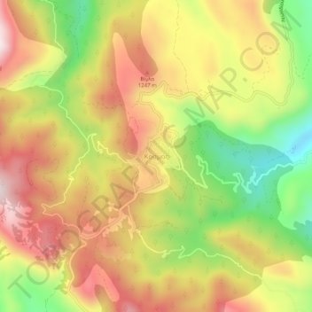
Nombre: Mapa topográfico Kosmas, altitud, relieve.
Altitud media: 1.097 m
Altitud mínima: 789 m
Altitud máxima: 1.364 m
Haz una donación