
Gracias por apoyar a este sitio ❤️
Haz una donación
Haz una donación
Mapa topográfico Rowleys Bay
Haga clic en el mapa para ver la altitud.
Gracias por apoyar a este sitio ❤️
Haz una donación
Haz una donación
Acerca de este mapa
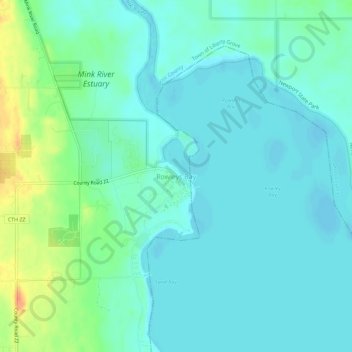
Nombre: Mapa topográfico Rowleys Bay, altitud, relieve.
Altitud media: 183 m
Altitud mínima: 172 m
Altitud máxima: 216 m
Gracias por apoyar a este sitio ❤️
Haz una donación
Haz una donación
Otros mapas topográficos
Haga clic en un mapa para ver su topografía, su altitud y su relieve.
Whitefish Dunes State Park
United States > Wisconsin > Door County > Sturgeon Bay
Altitud media: 181 m
Gracias por apoyar a este sitio ❤️
Haz una donación
Haz una donación
Rock Island
United States > Wisconsin > Door County
Rock Island is a mostly wooded island off the tip of Wisconsin's Door Peninsula at the mouth of Green Bay, in Door County, Wisconsin. The 974.87-acre (394.5 ha) island is approximately 1.6 miles (2.6 km) long and 1.1 miles (1.8 km) wide. It rises to 65 meters above Lake Michigan, making it the highest in…
Altitud media: 188 m
Bailey's Harbor Boreal Forest And Wetlands State Natural Area
United States > Wisconsin > Door County
Altitud media: 181 m
Gracias por apoyar a este sitio ❤️
Haz una donación
Haz una donación