
Gracias por apoyar a este sitio ❤️
Haz una donación
Haz una donación
Mapa topográfico Posthudorra/Porto Torres
Haga clic en el mapa para ver la altitud.
Gracias por apoyar a este sitio ❤️
Haz una donación
Haz una donación
Posthudorra/Porto Torres
The morphology of "city part" is flat; the area of Porto Torres and the rest of north-west Sardinia is characterized by a Nurra plain, with some hill formations in the middle of it. Part of this hill formation is in the municipality of Porto Torres, the highest elevation being Monte Alvaro, rising to a height of 342 m above sea level.
Gracias por apoyar a este sitio ❤️
Haz una donación
Haz una donación
Acerca de este mapa
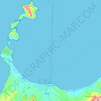
Nombre: Mapa topográfico Posthudorra/Porto Torres, altitud, relieve.
Altitud media: 15 m
Altitud mínima: -1 m
Altitud máxima: 418 m
Gracias por apoyar a este sitio ❤️
Haz una donación
Haz una donación