
Mapa topográfico James Bay
Haga clic en el mapa para ver la altitud.
Acerca de este mapa
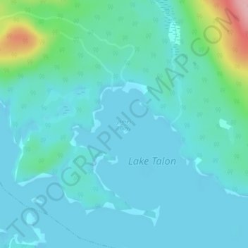
Nombre: Mapa topográfico James Bay, altitud, relieve.
Altitud media: 217 m
Altitud mínima: 191 m
Altitud máxima: 354 m
Otros mapas topográficos
Haga clic en un mapa para ver su topografía, su altitud y su relieve.
North Bay
Canada > Ontario > Nipissing District
The climate in North Bay is common to most places in Northern Ontario. North Bay tends to be a less humid climate than that found in Southern Ontario due somewhat to the distance from the Great Lakes and less warm than some other locations in Northern Ontario due to cooling from Lake Nipissing. On May 31,…
Altitud media: 266 m
Lake Nipissing
Canada > Ontario > Nipissing District
Lake Nipissing (/ˈnɪpəsɪŋ/; French: lac Nipissing, Ojibwe: Gichi-nibiinsing-zaaga’igan) is a lake in the Canadian province of Ontario. It has a surface area of 873.3 km2 (337.2 sq mi), a mean elevation of 196 m (643 ft) above sea level, and is located between the Ottawa River and Georgian Bay. Lake…
Altitud media: 272 m
Kawawaymog Lake
Canada > Ontario > Nipissing District > Unorganized South Nipissing
Altitud media: 385 m
Temagami
Canada > Ontario > Nipissing District
Temagami provides rugged topography, which is excellent for canoeing and hiking. There are numerous viewpoints in the municipality, including High Rock and Caribou Mountain, which contains a 100 ft (30 m) fire tower on its summit.
Altitud media: 319 m
Ralph Bice Lake
Canada > Ontario > Nipissing District > Unorganized South Nipissing
Altitud media: 464 m
Carcajou Lake
Canada > Ontario > Nipissing District > Unorganized South Nipissing
Altitud media: 291 m
Moccasin Lake
Canada > Ontario > Nipissing District > Unorganized South Nipissing
Altitud media: 465 m
Gilmour Island
Canada > Ontario > Nipissing District > Unorganized South Nipissing
Altitud media: 339 m
Coldspring Lake
Canada > Ontario > Nipissing District > Unorganized South Nipissing
Altitud media: 440 m
Windermere Lake
Canada > Ontario > Nipissing District > Unorganized South Nipissing
Altitud media: 355 m
Temagami
Canada > Ontario > Nipissing District
Temagami provides rugged topography, which is excellent for canoeing and hiking. There are numerous viewpoints in the municipality, including High Rock and Caribou Mountain, which contains a 100 ft (30 m) fire tower on its summit.
Altitud media: 319 m
North Bay
Canada > Ontario > Nipissing District
The climate in North Bay is common to most places in Northern Ontario. North Bay tends to be a less humid climate than that found in Southern Ontario due somewhat to the distance from the Great Lakes and less warm than some other locations in Northern Ontario due to cooling from Lake Nipissing. On May 31,…
Altitud media: 266 m
Maple Leaf Lake
Canada > Ontario > Nipissing District > Unorganized South Nipissing
Altitud media: 510 m
Temagami
Canada > Ontario > Nipissing District
Temagami provides rugged topography, which is excellent for canoeing and hiking. There are numerous viewpoints in the municipality, including High Rock and Caribou Mountain, which contains a 100 ft (30 m) fire tower on its summit.
Altitud media: 319 m