
Mapa topográfico Koolunga
Haga clic en el mapa para ver la altitud.
Acerca de este mapa
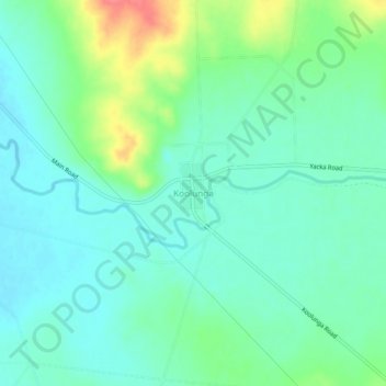
Nombre: Mapa topográfico Koolunga, altitud, relieve.
Altitud media: 131 m
Altitud mínima: 112 m
Altitud máxima: 180 m
Otros mapas topográficos
Haga clic en un mapa para ver su topografía, su altitud y su relieve.
Adelaide
Australia > South Australia > Adelaide City Council
South Australia was officially established as a British Province in England in February 1836. The first governor proclaimed the commencement of colonial government in South Australia on 28 December 1836, near The Old Gum Tree in what is now the suburb of Glenelg North. The event is commemorated in South…
Altitud media: 146 m
Inman Valley
In the valley is Selwyn Rock (35°29′47″S 138°30′45″E / 35.4965°S 138.5124°E / -35.4965; 138.5124) a glaciated pavement in the bed of the Inman River. It was first described in 1859 by, and later named for, A.R.C. Selwyn,[17] who was Victorian Government geologist at the time. Glacial…
Altitud media: 212 m
Mount Barker
Mount Barker is located on the plains surrounding the Mount Barker Summit, about 2 km west of the mountain itself, at 35°04′S 138°51′E / 35.067°S 138.850°E / -35.067; 138.850. Mount Barker is south east of Mount Lofty and Adelaide. It is to the north of The Coorong, and the west of Murray…
Altitud media: 368 m
Deep Creek National Park
Australia > South Australia > The District Council of Yankalilla
Altitud media: 183 m
Gumeracha
Gumeracha is also home to Applewood Distillery, Australia's highest altitude distillery, specialising in Gin and Amaro showcasing native Australian botanicals like finger limes and strawberry gum.
Altitud media: 408 m
Williamstown
Williamstown has an elevation of 310 m and an average rainfall of 680 mm. It has a summer average temperature of 31 °C with temperatures often reaching the mid 40s, and a winter average temperature of 15 °C, with nights dropping below freezing, which makes the region excellent for the cultivation of fruits,…
Altitud media: 310 m
Lyndoch
Lyndoch is a town in Barossa Valley, located on the Barossa Valley Highway between Gawler and Tanunda, 58 km northeast of Adelaide. The town has an elevation of 175m and an average rainfall of 560.5mm. It is one of the oldest towns in South Australia.
Altitud media: 216 m
Stirling
Many deciduous trees, particularly the maple, elm, oak and ash trees, have been imported from Europe and North America. These trees flourish in Stirling's wet and mild to cool climate and are a popular tourist attraction in the autumn months (April–May), bringing rich and vibrant autumn leaf colour to the…
Altitud media: 504 m