

Haz una donación
Mapa topográfico Eindhoven
Haga clic en el mapa para ver la altitud.
Haz una donación
Eindhoven
The villages and city that make up modern Eindhoven were originally built on sandy elevations between the Dommel, Gender and Tongelreep rivers. Beginning in the 19th century, the basins of the rivers themselves have also been used as housing land, resulting in occasional flooding in the city centre. Partly to reduce flooding, the bed of the Gender stream, which flowed directly through the city centre, was dammed off and filled up after the War, and the course of the Dommel was regulated. New ecological and socio-historical insights have led to parts of the Dommel's course being restored to their original states, and plans to have the Gender flow through the centre once again.
Haz una donación
Acerca de este mapa
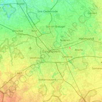
Nombre: Mapa topográfico Eindhoven, altitud, relieve.
Lugar: Eindhoven, North Brabant, Netherlands, 5611EB, Netherlands (51.27926 5.31863 51.59926 5.63863)
Altitud media: 21 m
Altitud mínima: 4 m
Altitud máxima: 56 m
Haz una donación