
Gracias por apoyar a este sitio ❤️
Haz una donación
Haz una donación
Mapa topográfico Jiuzhaigou
Haga clic en el mapa para ver la altitud.
Gracias por apoyar a este sitio ❤️
Haz una donación
Haz una donación
Jiuzhaigou
The Jiuzhaigou valley is part of the Min Mountains on the edge of the Tibetan Plateau and stretches over 72,000 hectares (180,000 acres). It is known for its many multi-level waterfalls, colorful lakes, and snow-capped peaks. Its elevation ranges from 2,000 to 4,500 metres (6,600 to 14,800 ft).
Gracias por apoyar a este sitio ❤️
Haz una donación
Haz una donación
Acerca de este mapa
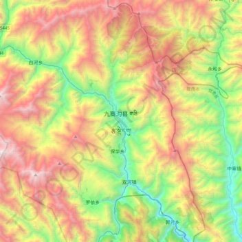
Nombre: Mapa topográfico Jiuzhaigou, altitud, relieve.
Altitud media: 2.552 m
Altitud mínima: 1.206 m
Altitud máxima: 4.352 m
Gracias por apoyar a este sitio ❤️
Haz una donación
Haz una donación