
Gracias por apoyar a este sitio ❤️
Haz una donación
Haz una donación
Mapa topográfico Col du Galibier
Haga clic en el mapa para ver la altitud.
Gracias por apoyar a este sitio ❤️
Haz una donación
Haz una donación
Col du Galibier
Before 1976, the tunnel was the only point of passage at the top, at an altitude of 2556 m. The tunnel was closed for restoration until 2002, and a new road was constructed over the summit. The re-opened tunnel is a single lane controlled by traffic lights, which are among the highest such installations in Europe.
Gracias por apoyar a este sitio ❤️
Haz una donación
Haz una donación
Acerca de este mapa
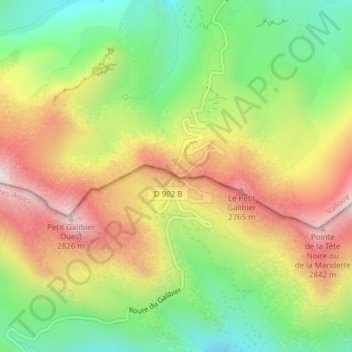
Nombre: Mapa topográfico Col du Galibier, altitud, relieve.
Altitud media: 2.491 m
Altitud mínima: 2.192 m
Altitud máxima: 2.832 m
Gracias por apoyar a este sitio ❤️
Haz una donación
Haz una donación