
Mapa topográfico Adama
Haga clic en el mapa para ver la altitud.
Adama
Adama (Oromo: Adaamaa or Hadaamaa, Amharic: አዳማ), formerly Nazreth (Amharic: ናዝሬት), is a city in central Oromia Region, Ethiopia. Adama forms a Special Zone of Oromia and is surrounded by East Shewa Zone. It is located at 8°32′N 39°16′E / 8.54°N 39.27°E / 8.54; 39.27 at an elevation of 1712 meters, 99 km southeast of Ethiopian capital, Addis Ababa. The city sits between the base of an escarpment to the west, and the Great Rift Valley to the east.
Acerca de este mapa
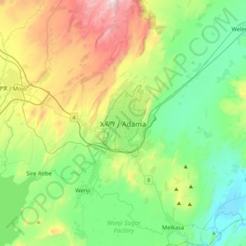
Nombre: Mapa topográfico Adama, altitud, relieve.
Lugar: Adama, Adama Special Zone, Oromia Region, 36, Ethiopia (8.38103 39.11055 8.70103 39.43055)
Altitud media: 1.673 m
Altitud mínima: 1.340 m
Altitud máxima: 2.447 m