
Mapa topográfico Le Buisson Sabot
Mapa interactivo
Haga clic en el mapa para ver la altitud.
Acerca de este mapa
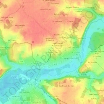
Nombre: Mapa topográfico Le Buisson Sabot, altitud, relieve.
Altitud media: 72 m
Altitud mínima: 40 m
Altitud máxima: 99 m
Otros mapas topográficos
Haga clic en un mapa para ver su topografía, su altitud y su relieve.
Le Clos Bruneau
France > Centre-Val de Loire > Indre-et-Loire > Artannes-sur-Indre
Le Clos Bruneau, Artannes-sur-Indre, Tours, Indre-et-Loire, Centre-Val de Loire, France métropolitaine, 37260, France
Altitud media: 74 m
Le Bourg
France > Centre-Val de Loire > Indre-et-Loire > Artannes-sur-Indre
Le Bourg, Artannes-sur-Indre, Tours, Indre-et-Loire, Centre-Val de Loire, France métropolitaine, 37260, France
Altitud media: 73 m