
Mapa topográfico Pala
Haga clic en el mapa para ver la altitud.
Acerca de este mapa
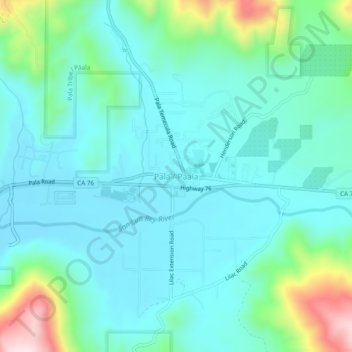
Nombre: Mapa topográfico Pala, altitud, relieve.
Lugar: Pala, San Diego County, California, 92059, United States (33.32531 -117.11670 33.40531 -117.03670)
Altitud media: 295 m
Altitud mínima: 90 m
Altitud máxima: 800 m
Otros mapas topográficos
Haga clic en un mapa para ver su topografía, su altitud y su relieve.
San Diego
United States > California > San Diego County
San Diego is characterized by a diverse topography that features coastal plains, rolling hills, and rugged mountain ranges. The city is situated along the Pacific Ocean, where it boasts an extensive shoreline with sandy beaches and tidal zones. As you move inland, the landscape transitions from the flat…
Altitud media: 125 m
Oceanside
United States > California > San Diego County
Oceanside features a diverse topography characterized by its coastal setting and gentle inland elevations. The city is predominantly flat, with its elevation averaging around 66 feet (20 meters) above sea level, allowing for expansive views of the Pacific Ocean along its roughly 3.5 miles of coastline. Inland,…
Altitud media: 32 m
Escondido
United States > California > San Diego County
Escondido has a borderline semi-arid climate (Köppen: Bsh) and hot-summer Mediterranean climate (Köppen: Csa) with hot summers and cool wet winters. Owing to its inland setting it is considerably warmer than coastal cities like San Diego, Carlsbad or Oceanside during the summertime, and cooler in the winter.…
Altitud media: 273 m
Ramona
United States > California > San Diego County > Ramona
In January 2006, Ramona Valley was designated the country's 162nd American Viticultural Area (AVA) by the Alcohol and Tobacco Tax and Trade Bureau, which recognized the area for its distinctive microclimate, elevation, and soil attributes.
Altitud media: 467 m
Encinitas
United States > California > San Diego County
Encinitas lies on rugged coastal terrace. The city is bisected by a low-lying coastal ridge that separates New and Old Encinitas. In the north of the city, the coast rises in elevation and the land is raised up in the form of many coastal bluffs. These cliffs are subject to collapsing on the narrow beach. The…
Altitud media: 32 m
Rancho Santa Fe
United States > California > San Diego County > Rancho Santa Fe
The climate of Rancho Santa Fe is, for the most part, typical of the San Diego metropolitan area though its higher elevation and inland location lends itself to larger temperature variations.
Altitud media: 68 m
Lake Murray Reservoir
United States > California > San Diego County > San Diego > San Carlos
Altitud media: 178 m
Jacumba
United States > California > San Diego County
Jacumba Hot Springs (/həˈkuːmbə/ hə-KOOM-bə) is an unincorporated community in the Mountain Empire area of southeastern San Diego County, California, United States. For statistical purposes, the United States Census Bureau defined Jacumba as a census-designated place (CDP) for the first time in the 2010…
Altitud media: 914 m
Pala
United States > California > San Diego County > Pala
The community is in the Pacific time zone. Pala is at an altitude of 404 feet, located at 33°21′55″N 117°04′36″W / 33.36528°N 117.07667°W / 33.36528; -117.07667 (latitude 33.365N, longitude 117.075W).
Altitud media: 245 m
La Mesa
United States > California > San Diego County
The climate in the San Diego area, like much of California, often varies significantly over short geographical distances, resulting in micro-climates. In San Diego's case, this is mainly due to the city's topography (the Bay, and the numerous hills, mountains, and canyons). Frequently, particularly during the…
Altitud media: 171 m
Alpine
United States > California > San Diego County > Alpine
It sits on both sides of Interstate 8 at the eastern extent of the California coastal region and the western extent of the Peninsular Ranges, about 30 miles east of downtown San Diego, at an elevation of about 2,000 feet.
Altitud media: 581 m
National City
United States > California > San Diego County
Like most of Southern California and the San Diego County region, the majority of National City's current area was originally occupied by chaparral, a plant community made up mostly of drought-resistant shrubs. National City's broad city limits encompass the San Diego National Wildlife Refuge and the most…
Altitud media: 20 m
Los Peñasquitos Canyon Preserve
United States > California > San Diego County > San Diego > Sorrento Valley
Altitud media: 95 m
Cleveland National Forest
United States > California > San Diego County
The Cleveland National Forest encompasses 460,000 acres/720 sq mi (1,900 km2) of inland montane regions—approx. 60 miles from the Pacific Ocean—within the counties of San Diego, Riverside, and Orange, California. The landscape varies somewhat, with mostly chaparral canyons, arroyos and high desert, but…
Altitud media: 596 m
La Presa
United States > California > San Diego County > Imperial Beach > La Presa
Altitud media: 121 m
San Diego Country Estates
United States > California > San Diego County > San Diego Country Estates
Altitud media: 577 m
Santee
United States > California > San Diego County
At an altitude of 1,198 feet (365 m), Rattlesnake Mountain is the highest point in Santee. Rattlesnake Mountain is home to the Sky Ranch community, and is topped with a large illuminated star during the holiday season.
Altitud media: 172 m
Steele/Burnand Anza-Borrego Desert Research Center
United States > California > San Diego County > Borrego Springs
Altitud media: 250 m
Campo
United States > California > San Diego County > Lake Morena Village
An unnamed private air strip is 4.2 miles (6.8 km) at 332 degrees off true north at 32°39′35″N 116°30′08″W / 32.65972°N 116.50222°W / 32.65972; -116.50222. The name of the field is not listed in the National Geographic Names Data Base or U.S. Department of Transportation, Federal Aviation…
Altitud media: 943 m
Rancho San Diego
United States > California > San Diego County > Rancho San Diego
Altitud media: 179 m
Pala Reservation
United States > California > San Diego County > Sacred Mountain Wellness Village
The reservation occupies parts of four 7.5 minute topographic maps: Boucher Hill, Pala, Pechanga, and Vail Lake, California. The area consists of an area in and around Pala, California. The enrolled tribal members descend from two Indian groups: a band of the Luiseño tribe, and the Cupeño Indians, who were…
Altitud media: 392 m
Cabrillo National Monument
United States > California > San Diego County > San Diego
The Old Point Loma Lighthouse is the highest point in the park and has been a San Diego icon since 1855. The lighthouse was closed in 1891, and the New Point Loma Lighthouse opened at a lower elevation, as fog and low clouds often obscured the light at its location 129 meters (422 feet) above sea level. The…
Altitud media: 13 m
Mission Trails Regional Park
United States > California > San Diego County > San Diego > San Carlos
Altitud media: 178 m
San Diego
United States > California > San Diego County
The climate in San Diego, like most of Southern California, often varies significantly over short geographical distances, resulting in microclimates. In San Diego, this is mostly because of the city's topography (the Bay, and the numerous hills, mountains, and canyons). Frequently, particularly during the "May…
Altitud media: 125 m
Torrey Pines State Natural Reserve
United States > California > San Diego County > San Diego
Altitud media: 37 m
San Diego
United States > California > San Diego County
The climate in San Diego, like most of Southern California, often varies significantly over short geographical distances, resulting in microclimates. In San Diego, this is mostly because of the city's topography (the Bay, and the numerous hills, mountains, and canyons). Frequently, particularly during the "May…
Altitud media: 125 m
La Mesa
United States > California > San Diego County
The climate in the San Diego area, like much of California, often varies significantly over short geographical distances, resulting in micro-climates. In San Diego's case, this is mainly due to the city's topography (the Bay, and the numerous hills, mountains, and canyons). Frequently, particularly during the…
Altitud media: 171 m
Cleveland National Forest
United States > California > San Diego County
Cleveland National Forest is a U.S. national forest in Southern California that encompasses 460,000 acres/720 sq mi (1,900 km2) of inland montane regions. It is approximately 60 miles from the Pacific Ocean, within the counties of San Diego, Riverside, and Orange. The landscape varies somewhat, with mostly…
Altitud media: 596 m
Escondido
United States > California > San Diego County
Escondido has a borderline semi-arid climate (Köppen: Bsh) and hot-summer Mediterranean climate (Köppen: Csa) with hot summers and cool wet winters. Owing to its inland setting it is considerably warmer than coastal cities like San Diego, Carlsbad or Oceanside during the summertime, and cooler in the winter.…
Altitud media: 273 m
Alpine
United States > California > San Diego County > Alpine
Alpine sits on both sides of Interstate 8 at the eastern extent of the California coastal region and the western extent of the Peninsular Ranges, about 30 miles (48 km) east of downtown San Diego, at an elevation of about 2,000 feet (610 m).
Altitud media: 581 m
San Diego
United States > California > San Diego County
The climate in San Diego, like most of Southern California, often varies significantly over short geographical distances, resulting in microclimates. In San Diego, this is mostly because of the city's topography (the Bay, and the numerous hills, mountains, and canyons). Frequently, particularly during the "May…
Altitud media: 125 m
National City
United States > California > San Diego County
Like most of Southern California and the San Diego County region, the majority of National City's current area was originally occupied by chaparral, a plant community made up mostly of drought-resistant shrubs. National City's broad city limits encompass the San Diego National Wildlife Refuge and the most…
Altitud media: 20 m
Encinitas
United States > California > San Diego County
Encinitas lies on a rugged coastal terrace. The city is bisected by a low-lying coastal ridge that separates New and Old Encinitas. In the north of the city, the coast rises in elevation and the land is raised up in the form of many coastal bluffs, which are subject to collapsing on the narrow beach. The city…
Altitud media: 32 m
Pine Valley
United States > California > San Diego County
According to the United States Geological Survey, Pine Valley is located 3,736 feet (1,139 m) above sea level, at 32°49′17″N 116°31′45″W / 32.82139°N 116.52917°W / 32.82139; -116.52917. Interstate 8 passes east-to-west along the southern border of Pine Valley. It crosses the Pine Valley…
Altitud media: 1.291 m
La Mesa
United States > California > San Diego County
The climate in the San Diego area, like much of California, often varies significantly over short geographical distances, resulting in micro-climates. In San Diego's case, this is mainly due to the city's topography (the Bay, and the numerous hills, mountains, and canyons). Frequently, particularly during the…
Altitud media: 171 m
Anza-Borrego Desert State Park
United States > California > San Diego County
Anza-Borrego Desert State Park lies in a unique geologic setting along the western margin of the Salton Trough. This major topographic depression with the Salton Sink having elevations of 200 ft (61 m) below sea level, forms the northernmost end of an active rift valley and a geological continental plate…
Altitud media: 606 m
Escondido
United States > California > San Diego County
Escondido has a borderline semi-arid climate (Köppen: Bsh) and hot-summer Mediterranean climate (Köppen: Csa) with hot summers and cool, wet winters. Owing to its inland setting, it is considerably warmer than coastal cities like San Diego, Carlsbad or Oceanside during the summertime, and cooler in the…
Altitud media: 273 m
San Diego
United States > California > San Diego County
The climate in San Diego, like most of Southern California, often varies significantly over short geographical distances, resulting in microclimates. In San Diego, this is mostly because of the city's topography (the Bay, and the numerous hills, mountains, and canyons). Frequently, particularly during the "May…
Altitud media: 125 m
Ramona
United States > California > San Diego County > Ramona
In January 2006, Ramona Valley was designated the country's 162nd American Viticultural Area (AVA) by the Alcohol and Tobacco Tax and Trade Bureau, which recognized the area for its distinctive microclimate, elevation, and soil attributes.
Altitud media: 467 m