
Mapa topográfico Lucknow
Mapa interactivo
Haga clic en el mapa para ver la altitud.
Acerca de este mapa
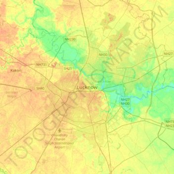
Nombre: Mapa topográfico Lucknow, altitud, relieve.
Lugar: Lucknow, Lucknow District, Uttar Pradesh, 226027, India (26.67810 80.77460 26.99810 81.09460)
Altitud media: 120 m
Altitud mínima: 103 m
Altitud máxima: 131 m