
Mapa topográfico Yichang
Haga clic en el mapa para ver la altitud.
Acerca de este mapa
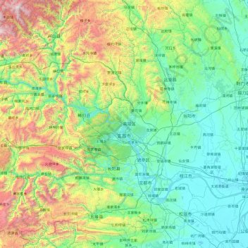
Nombre: Mapa topográfico Yichang, altitud, relieve.
Lugar: Yichang, Hubei, China (29.94557 110.25026 31.58139 112.08053)
Altitud media: 592 m
Altitud mínima: 27 m
Altitud máxima: 2.833 m
Otros mapas topográficos
Haga clic en un mapa para ver su topografía, su altitud y su relieve.
Presa de las Tres Gargantas
La Garganta de Qutang (en chino: 瞿塘峡) cuenta con 8 km, que la convierte en la primera y la más corta de las tres. Aguas abajo de la aldea de Baidicheng (en chino: 白帝城) (zona de Fengjie) el río Yangtsé fluye entre el Chijia el norte y el Baiyan (en chino: 白盐山) al sur. De este punto se dice…
Altitud media: 95 m